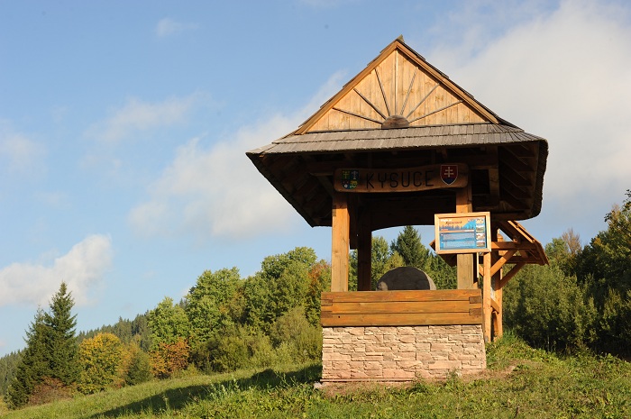
Kysucké rarity
Characteristics: The circuit with one more demanding rise to Živčáková hill – Kysuce Lourdes, a well known pilgrimage place with a chapel and mineral water springs.
Go down to the village of Korňa, where you can see the crude spring.
Length: 12 km / 3:00 h, Elevation: 316 m, Difficulty: medium
Description of the trail: Turzovka (centre ) – Turzovka – Vyšný koniec (Upper End) – Živčáková – Korňa – Korniansky crude spring – Turzovka – Predmier
To the spring of Kysuca
1st option:
Length: 14 km / 4:15 h, Elevation: 330 m, Difficulty: medium
Description of the trail: Makov (Centre) – Makov (Čierne) – Settlement “U Lovasov” – Čemerky – Kopanice – Kysuca River spring – Kopanice – Makov Centrum
Characteristics: Circular tour from the centre of Makov through picturesque mountainous settlements. Take the yellow-marked trail from Kopanice to one of the springs of Kysuca River. Then go back to Kopanice and to the centre of Makov by the main road.
2nd option:
Length: 7.8 km
Characteristics: To the spring of Kysuca from Makov to Kopanice, then follow the yellow tourist mark (8549) to Saddle under Lemešná, then follow the red tourist trail (0842) towards Saddle under Hričovec, and after a steep rise to “Pod Soliskom” take the new yellow tourist mark (8693) for approximately 1 km to the regulated spring of the river Kysuca. There you will find an information panel and a roofed gazebo, where you can sit and relax and fill your bottle with water.
Bumbálka-Klokočov
Length: 6:10 h, in opposite direction: 6:15 h
Description of the trail: Bumbálka (850 metres above sea level) – Masarykova cottage (880 metres above sea level) 0:15 h – Smutníky (840 metres above sea level) 0:20 h – Chata Kmínek (845 metres above sea level) 0. 40 h – Hluchanka (775 metres above sea level) 1:25 h – Bobek (871 metres above sea level) 2:25 h – Konečná (720 metres above sea level) 3:25 h – Doroťanka (690 metres above sea level) 4:30 h – Biely Kríž (852 metres above sea level) 5:25 h – Klokočov – Vrchpredmier (597 metres above sea level) 6:10 h.
Characteristics: Almost the whole trail goes closely along the Slovak–Czech border along a splendid ridge that separates the Moravian–Silesian Beskydy Mountains from Turzovská Highlands. It is one of the most beautiful ridge trails in Beskydy. Since the ridge is only a little rugged, the trail is rather easy. In winter, it is very popular among cross-country skiers. The trail begins at a frequented border crossing called Bumbálka, on red-marked trail No. 0633. Go around hotel Bumbálka and the mountain rescue service site, very slightly uphill around small ski lifts to Masarykova cottage. Right behind the cottage there is a small hill that offers beautiful views of the Moravian – Silesian Beskydy Mountains and of Javorníky ridge. Lysá Hora Mountain with a TV transmitter serves as your orientation point almost throughout the whole trip. After a steeper downhill trek you will come to Smutníky (blue trail on the right leads to Makov) and the red tourist trail will lead you to cottage Kmínek. Continue alongside the border around the partially destroyed cottage of Janošec to Hluchanka (here the blue trail No. 2254 from Moravian side ends). A non-marked trail continues to Vyšný Kelčov, however you stick to the red tourist trail to Bobek. The barren peak offers nice views of the vast Beskydy Mountains, the forests around Javorníky and the distant Malá Fatra Mountains. Blue Moravian trail No. 2253 joins here. Through an undulating terrain, over Tobolovci hill, around settlement Smažákovci you will arrive to Cottage under Konečná. You will cross the road border crossing Klokočov-Bílá. Green Slovak trail and blue Moravian trail join here. Continue above the settlement Baraní and under the hill Čudácka to cottage Doroťanka. You will pass spruce forests, pastures, mountain meadows and small fields, you will go through several settlements (used for recreation purposes only) and rise to hill Súľov. Biely kríž lies under Súľov. In the past it used to be a popular recreation facility with one of the most beautiful hotels – the cottage of Kysuca and sanatoriums (views from the terrace of cottage are noteworthy). Today, Biely kríž is used for private and corporate recreation events only. Several tourist trails cross at Biely Kríž. Return a little bit and on the first crossing turn left to the yellow tourist trail No. 8543 that will lead you to the end point of the trip – settlement Vrchpredmier (Klokočov), where you can take a bus.
Turzovka-Raková
Length: 8:35 h, in the opposite direction: 8:10 h
Description of the trail: Turzovka (475 metres above sea level) – Košariská (675 metres above sea level) 1:15 h – the settlement of Hlinené (737 metres above sea level) 2:05 h – Hlinené (860 metres above sea level) 2:40 h - Nad Fučkovcami (750 metres above sea level) 3:10 h – Hrubý Buk (595 metres above sea level) 3:40 h – Uhorská (1000 metres above sea level) 5:15 h – Čuboňov (935 metres above sea level) 5:35 h – Saddle under Muřínkový Hill (960 metres above sea level) 6:35 h – Veľký Polom (1 067 metres above sea level) 7:05 h – Nad Kurajkou (660 metres above sea level) – 8:05 h – Raková – Korcháňovci (535 metres above sea level) 8:35 h.
Characteristics: The trail goes through the Turzovská Highlands and follows the state border near the Moravia – Silesian Beskydy Mountains through Veľký Polom. Besides nice views from several places throughout the trip, you can also enjoy two nature reservations – Klokočovské Rocks and Veľký Polom. Even though the trail is rather long, it is quite easy and rises are rather slight.
The railway station in Turzovka is the starting point. Blue tourist trail No. 2670 will take you to Čuboňov. After crossing the town you will get to a road bridge over the Kysuca river where a yellow mark branches off. Behind the bridge you will start rising through the settlement of Košariská (there is a view of settlement Klokočov – Riečky) up to the crossroad above the settlement of Hlinené. It offers nice views of dispersed settlements. Behind the settlement you will enter a forest and continue to the hill Hlinené, where you can have a rest in a picturesque meadow. Go downhill to the ridge and follow the red tourist trail No. 0841 to the intersection at Nad Fučkovcami, then switch to the blue trail until you arrive to settlement Hrubý Buk (BUS). Turn left at a transformer and after a short rise you will arrive at the nature reservation of Klokočovské rocks. Go out of the forest and continue by a field path through an open space, where you can enjoy views of the Kornická furrow, through settlements Zajacovci and Fujákovci ( the nature reservation of Polková is 0.5 km to the west), then take a forest trail to rise to Uhorská. The peak of Uhorská is situated off the trail; however you can enjoy a nice view from the saddle under the peak in altitude of 1,000 metres above sea level (the green tourist trail No. 5540 leads to settlement Vrchpredmier along an old military road built by the Germans during World War II probably to transport artillery to the peak). You will arrive at Čuboňov, close to the border of the Czech Republic. Follow the red-marked trail that goes through a forest most of the time, under Burkov hill and Muřínkový hill to the saddle with a picturesque chapel, a spring with delicious water and a place to rest. Then take a short steep rise along a reef slope to the highest point of the trail – Veľký Polom (a nice view place, 1,067 metres above sea level with nature reservations on both sides of the state border). Take the blue trail No. 2672 alongside the border to a crossing and continue by the blue trail, around the tourist information point “Na Kurajkou” to settlement Korcháňovci (belonging to village Raková), where you can take a bus.
To Veľká Rača by educational trail
Length: 6.9 km (Y 8541 + G 5542), or 7.4 km (G 5542)
Description of the trail: Oščadnica, Dedovka (Y) - Príslop (2.7 km) (G) - Pod Hladkou (4.3 km) (G) - Cottages at Rača, crossing (4.8 km) (G) - Veľká Rača, peak (6.9 km) or Oščadnica, Vyšný koniec (G) - Veľká Rača, peak (7.4 km)
Characteristics: Veľká Rača with altitude of 1,236 metres is the highest peak of Kysuce Mountains that lies on the border to Poland. The time of the rise from the set-off point in Dedovka by the yellow tourist trail to the last stop at the peak of Veľká Rača with a 630-metre elevation is approximately 2 hours. The peak is easily accessible by marked tourist trails in summer and in winter as well. You can find brief information about the territory on every of the 6 stops. During your rise to the peak you can see various pseudo-karst phenomena – Small rock hole (Malá skalná diera - 9 metres long) and Big rock hole (Veľká skalná diera - 22 metres long), which occur sporadically in the territory of Kysuce. The main ridge is an important European Danube–Wisla watershed. In the event of good weather, you can enjoy nice panorama views from the ridge. On the peak there is a small lookout tower with a layout of the views, a wooden cross and a Polish tourist cottage open the whole year round.
From Čadca through Javorské to Oščadnica
Length: 11 km (R 0840 + Y 8570)
Description of the trail: Čadca, TESCO (R) - Bryndzárovci (2.2 km) (R) - Javorské (6.0 km) (Y) - Oščadnica, square (11.0 km)
Characteristics: From TESCO in Čadca along the Kysuca River on the way to Bukov (a 2km detour to Bukovský mineral spring). Turn right in front of the chapel and rise through the settlement Bryndzárovci up to Javorské. During almost the whole trip you can enjoy beautiful views of the surroundings. Turn downwards and continue through the settlement Kubuši to the centre of Oščadnica.
From Čadca through Skalité to Zwardoň
Length: 21.7 km (R 0840 + Y 8568) through Skalité to Zwardoň
Description of the trail: 2nd option: Čadca, TESCO (R) - Javorské (6.0 km) (R) - Za Lieskovou (9.8 km) (R) - Skalité (14.0 km) (R) - Skalité, Serafínov (20.8) (Y) - Zwardoň, saddle (21.7 km)
Characteristics: From TESCO in Čadca along the Kysuca River on the way to Bukov (a 2km detour to Bukovský mineral spring). Turn right in front of the chapel and rise through the settlement Bryndzárovci up to Javorské. During almost the whole trip you can enjoy beautiful views of the surroundings. This trail goes through Beskydok and Liesková (beautiful views from the peak) to Tri kopce (also the green trail No. 5541). Take a panel road that descends to Skalité. Then take a steep rise to Poľana, where you can enjoy stunning panorama views. In front of the last hill turn right to the panel road and you will arrive to a crossing with a road leading to Poland. Go over the bridge above the road and continue through a small hill and then descend to the railway station in Skalité, Serafínov. Then follow the yellow mark to Zwardoň.
Malé (Small) bulwarks, Ramparts and Trojmed
Length: 11.5 km
Characteristics: The starting point is in the village of Čierne-Vyšný koniec (Upper end). The marked trail begins at the railway station. Follow the blue tourist mark and rise to the ridge of Valy. During the trip you will see soil ramparts and on 3 places you will see square redutas with dimensions 25x25 m. At the end of the ridge you will arrive to Malé (Small) bulwarks with an information board. From the border near the river Čadečka continue to Poland by the red tourist trail and after a 10-minute walk turn left and follow the green mark to the centre of Jaworzynka (you can visit the regional museum “Na Grapie”). Then go by the yellow trail and by the asphalt road that rises up to the border on the Czech Republic. Then turn left and follow the trail to the village of Hrčava. During a snack break you can visit a wooden church dedicated to Cyril and Methodius. From Hrčava, follow the yellow mark again and descend to the brook and then rise to Trojmedzie. At Trojmedzie you are allowed to prepare a fire and barbecue a sausage or bacon, if you have any, in one of the fireplaces provided and you can relax in one of the gazebos. Cross the wooden bridge to the Slovak side, from the Slovak monolith turn right, take an unmarked (but well-conditioned) trail to the blue trail and return back to the starting point. The trail is easy and suitable for tourists of all ages.
Old (Staré) Bulwarks, Jablunkovské Bulwarks, Megoňky
Length: 11.5 km (8.9 km from Megoňky)
Characteristics: Čadca is the starting point. Take a bus to the station at Čadca, Milošová, U Kadlubca. Follow the yellow tourist mark around the water reservoir Milošová, rise to a moderate slope and enjoy nice views along the way until you arrive at the stone spheres in Megoňky (terminal bus station – starting point of the shorter trail). Continue to Mosty U Jablunkova, Bulwarks (snack). Continue by the green tourist trail and after 500 metres you will arrive at Jablunkovské Bulwarks. Continue through the settlement of Dejovka to Staré (Old) Bulwarks (currently a telecommunication transmitter). There you can take a rest in a tourist shelter. Take the panel road to Svrčinovec, the final point of our trip. You can take a bus or train to Čadca. The trail is easy and suitable for people of all ages.
Walks to chapels of Oščadnica
We recommend seeing all the local chapels during your walks through the village of Oščadnica. You can reach them on foot or by bicycle. The walks that will take you to various settlements of Oščadnica are suitable for people of all ages.
Chapel “za Dedovou” was built in 1948 and it is used as a bell tower. The citizens of the local settlement have always wanted a chapel, where they could meet and worship. It lies outside the settlement. You can reach it by the yellow tourist trail (8541) from Dedovka or by the green tourist trail (5542) from the local part Vyšný koniec (Upper end). Chapel “u Švancari” was built in 1961. It lies directly in the settlement of Švancárovci on the green tourist trail (5541) approximately 200 metres from the access road to the village. Chapel “u Haladeji” was also built in 1961. You can get there from the settlement of Lalíkovci by the blue tourist trail (2671). After approximately 800m turn left to a road leading to the settlement of Haladejovci. The Chapel in Rovne was restored in 1982 and you can get to it by the steep road leading between the houses, then turn left after approximately 800 metres and continue for approximately 400 metres. The chapel lies behind the houses. Chapel Vrečšovka lies in the settlement of Vreščovka near the bus station.
Trails in Horný Kelčov
Vyšný Kelčov, Rieka (BUS) – TO Hluchánka (0,6 km, + 70 m) – TO Janošec (1,2 km, + 110 m) – Korytovo 861 m – TO Ch. Kmínek (2 km, +90 m, -70 m) – TO Volarská(1,3 km, -20 m) – Huslov – Pokrývky – TO Nižný Kelčov (4,1 km, +80 m, -320 m, - BUS, vlak).
Photos:


https://www.regionkysuce.sk/en/sport-opportunities/hiking-trails/314-hiking-trails#sigProId7e4edf5a29
